Choose timezone
Your profile timezone:
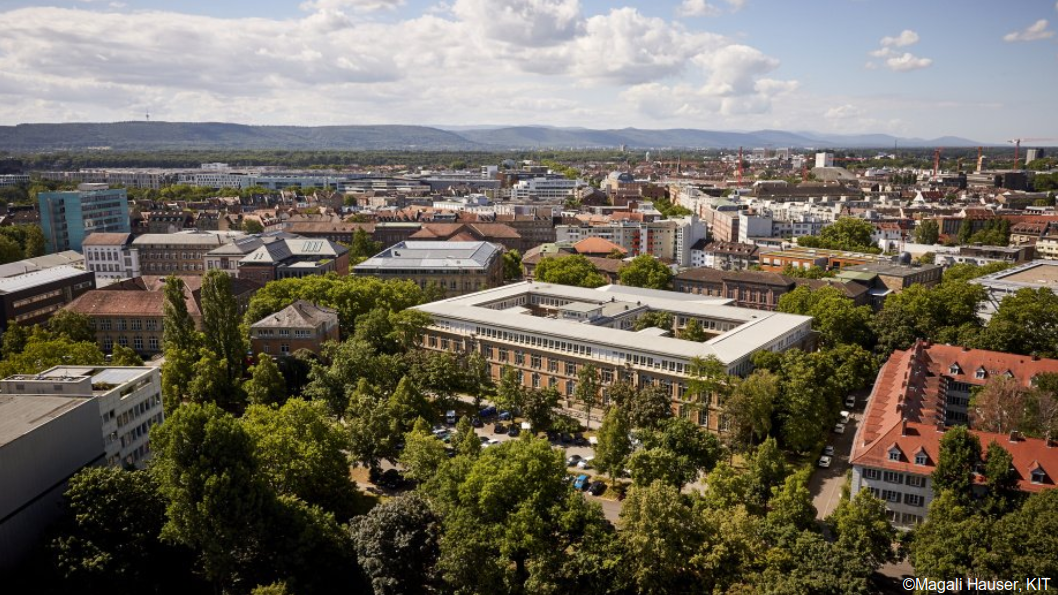
16-17 October 2024, KIT Campus Süd, Englerstr. 7, 76131 Karlsruhe
The Collaboration across Research Fields (CARF) in Remote Sensing aims to link remote-sensing research within Helmholtz across the research fields Earth and Environment and Aeronautics, Space and Transport (DLR). Well-established and long-standing collaboration and newly established links alike are in the focus of our activities.
This workshop is intended to showcase recent and future developments in remote sensing within Helmholtz, and to identify potentials for future collaboration. See programme tab for details.
Participation by early-career scientists is expressly encouraged.
The workhop will be held on the downtown campus of KIT, a short walk from the nearest transit stop, and roughly 15 minutes from Karlsruhe Hbf.
We are looking forward to welcoming you to the workshop in Karlsruhe!
The CARF steering committee:
Jan Cermak, KIT (local host)
Stefan Dech, DLR
Michael Eineder, DLR
Martin Hieronymi, Hereon
Angelika Humbert, AWI
Doris Klein, DLR
Jian Peng, UFZ
Florian Schütte, Geomar
Markus Rapp, DLR
Diana Rechid, Hereon
Martin Riese, FZJ
Sigrid Roessner, GFZ
Jens Wickert, GFZ
The proposed satellite mission CAIRT (Changing-Atmosphere Infra-Red Tomography Explorer), an ESA Earth Explorer 11 candidate, is an instrument capable of measuring trace gas concentrations and temperature throughout the Middle Atmosphere. The aim is to observe the altitude range of about 5 to 115 km at a 1 km vertical sampling across a swath width of about 400 km using a limb-viewing measurement geometry. The instrument will allow for a 50 km along-track and about 25 km across-track sampling, giving unprecedented coverage of global Gravity Wave events. Thereby, CAIRT will be the first mission to provide a comprehensive view of the middle atmosphere including circulation and its driving, composition, and chemistry (more information at https://www.cairt.eu/).
To assess the possible GW observations with CAIRT, we use synthetic temperature measurements and apply our wave analysis tool, S3D, to determine the GW content. This results in the full characterization of the GW amplitude, 3D wave vector, and phase of up to 6 wave components from small 3D cuboids of the residual temperature field. We show that the global GWMF distributions as simulated from the CAIRT observations are in agreement with the wave analysis directly applied to the high-resolution model winds. Furthermore, spectra of wavelength and phase speeds (and their direction) can be determined from the observations. In particular, the latter poses a challenge to the quality of the observations; however, even with higher-than-expected instrument noise, the phase speed spectra are in good agreement with the reference data.
Finally, the high vertical resolution of the observations allows the estimation of GW drag directly from the GWMF distributions via the vertical rate of change. In particular, we investigate the role and distribution of GW drag during the northern hemisphere SSW in January 2006.
The brand-new instrument GLORIA-Lite, developed by the Institute of Meteorology and Climate Research (IMKASF) at KIT in close collaboration with the institutes ICE4 and ZEA2 at Forschungszentrum Jülich (FZJ) was launched on board a large stratospheric balloon by a team of the Centre National d'Études Spatiales (CNES) from the European Space and Sounding Rocket Range (ESRANGE, Swedish Space Corporation), on June 22, 2024. It flew at an altitude of 40 km from northern Sweden (Kiruna) to Canada, crossing over the North Atlantic and Greenland and landed safely in the northern part of Baffin Island on June 26. There, the instrument as well as the data collected during the flight were recovered and can be reused for future measurement campaigns upon their return to KIT.
GLORIA-Lite is a completely newly developed instrument designed to continue the decades-long series of measurements by its predecessors GLORIA and MIPAS. The significant reduction in size and weight through the use of the latest infrared sensors, customized electronics and innovative manufacturing techniques also enables the use on transcontinental balloon flights. At its core, GLORIA-Lite features an imaging Fourier-transform spectrometer that analyses infrared emissions by more than 20 different molecules and aerosols in the atmosphere. Our goal is to better understand the various dynamic and chemical processes from the middle troposphere towards deep into the stratosphere. In times of accelerating climate change, it is particularly important to study the impacts on the middle atmosphere and to monitor them through long-term measurement series. For instance, the increasingly frequent and higher-reaching forest fires are contributing to a changes in the entry of air pollution into the stratosphere.
Additionally, GLORIA-Lite serves as a demonstrator for the satellite project CAIRT, which builds on the long-standing joint initiative of KIT and FZJ and has been proposed by an international consortium of ESA. CAIRT (www.cairt.eu) reached the "final" in the 2023 selection process, where the "winner" will be determined from the two remaining instrument proposals in 2025, scheduled to be launched into space in the early 2030s.
Atmospheric dynamics are composed largely of atmospheric circulations of different scales. One such circulation is the mesospheric pole-to-pole circulation, which gives rise to the intriguing phenomenon whereby the polar summer mesosphere, despite receiving 24 hours of sunlight, is the coldest region in the atmosphere. Circulations in general are governed by atmospheric waves, which again come in various shapes and sizes. The pole-to-pole circulation of the upper mesosphere in particular is driven by so-called gravity waves. Gravity waves are buoyancy waves where gravity serves as the restoring force. These waves carry energy and momentum from the lower atmosphere into the mesosphere and lower thermosphere. As gravity waves travel vertically with wavelengths on the scale of kilometers, they can be well measured by a satellite with a limb looking configuration. In recognition of the significance of accurately measuring these atmospheric dynamics, researchers have developed advanced instrumentation to capture the intricate details of these phenomena. This brings us to a significant joint initiative aimed at enhancing our understanding of the upper mesosphere.
A collaborative effort between the Jülich Research Center and the University of Wuppertal
in Germany led to the development of such a limb sounding instrument. The instrument's primary objective is to provide vertical temperature profiles with a fine vertical sampling of 1.5 km. These precise measurements enable the effective capture and analysis of small to medium-scale gravity waves in heights of about 90-130km, which is crucial for understanding the energy and momentum transfer in the atmosphere. The measurement principle is based on spectral information which is captured by an imaging Spatial Heterodyne Interferometer. This is essentially a Michelson interferometer with the two mirrors exchanged with blazed gratings in Littrow configuration. The spectrum is extracted from the interferogram which is superimposing the image on the detector. To specifically observe the oxygen A-band emissions, a bandpass filter of \SI{6}{nm} centered around \SI{763}{nm} is used. The Oxygen A-band was chosen as it peaks around \SI{90}{km} and from its relative spectral band shape, the temperature can be directly derived. The instrument is scheduled to be launched on the International Satellite Program in Research and Education (INSPIRE) Sat-3 mission, led by the Indian Institute of Space Science and Technology. The objective of the mission is twofold: to acquire expertise for all participating scientists and to validate the onboard instruments in orbit. Furthermore, the mission aims to integrate into the INSPIRE constellation, providing a constellation of Earth and space weather-monitoring satellites. The expected outcomes include enhanced models of atmospheric dynamics and will facilitate more accurate space weather and climate predictions.
Technological advances have led to the wide-spread adoption of Unoccupied aerial vehicles (UAV) as versatile platforms for a range of sensors in the domain of remote sensing. In particular, observation opportunities of the Earth's surface have multiplied. The field has already seen some specialisation into small, easy-to-use, off-the-shelf solutions versus heavier, high-end platforms and sensors. UAV activities at the Section Remote Sensing and Geo-informatics of GFZ involve both ends of this spectrum. This contribution will give an overview of these activities that include:
- geohazards observations, including volcanos, with radar;
- CO2 and CH4 flux measurements of peatlands;
- soil (in particular SOC) and vegetation characterisation with VNIR/SWIR hyperspectral observations;
- sensing of 3D structures (especially vegetation and forests) and surfaces with lidar;
- observation of dynamic vegetation with high-resolution, multi-spectral observations.
Furthermore, the current status of UAV operational procedures at GFZ will be shortly presented. In this context, the operationalisation of operations as well as possible transfer options will be discussed.
Since 2019, several countries and agencies have successfully launched a number of spaceborne imaging spectroscopy systems in orbit or on the International Space Station (ISS) such as DESIS, PRISMA, HISUI, GF-5, EnMAP and EMIT. Among these recent missions, the German Environmental Mapping and Analysis Program (EnMAP) stands for its long-term development, sophisticated design with on-board calibration, high data quality requirements, and strong science accompanying program. EnMAP was launched in April 2022 and, following a successful commissioning phase, started its operational activities in November 2022. EnMAP has been a long-term collaboration between the energy fields as a DLR/GFZ mission with DLR leading the overall management and coordination, and the ground segment, and GFZ leading the science segment, OHB building the space segment. The EnMAP mission encompasses global coverage from 80° N to 80° S through on-demand data acquisitions. Data are characterized by open free access, 30 m spatial resolution, high spectral resolution with a spectral sampling distance of 6.5 nm and 10 nm in the VNIR and SWIR regions respectively, and high signal-to-noise ratio. In this presentation, we show the science potential of EnMAP for space-based imaging spectroscopy to operate in various environments, including high and low light levels, dense forests, Antarctic glaciers, arid agricultural areas. This enables various applications in field such as agriculture and forest, soil compositional mapping, raw materials, methane mapping, water quality assessment, and snow and ice properties. Overall, EnMAP’s performance exceeds the mission requirements, and significant potential for contribution to scientific exploitation in various geo- and bio-fields is demonstrated. EnMAP is also expected to serve as a key tool for the development and testing of data processing algorithms for upcoming global operational missions such as upcoming Copernicus mission CHIME and NASA mission SBG.
The Environmental Mapping and Analysis Program (EnMAP) is a German spaceborne imaging spectroscopy mission aimed at providing accurate information on the state and evolution of ecosystems, their response to human activities and the management of natural resources. Since November 2022, nearly 3000 scientific users from over 90 countries have registered for receiving data. Users feedback, as collected during these years at conferences and workshops dedicated to hyperspectral imagery, is extremely positive.
All mission data are freely available for scientific use worldwide. The EnMAP planning system accepts scientific observation requests from users upon submission and approval of an observation proposal for future acquisition requests and also gives access to archived data.
Over the course of more than two years of operation, several enhancements have been made to the mission, significantly improving the quality and accessibility of data.
In this talk, we will give an overview of the mission, the current acquisition strategy based on the foreground and background mission concepts and the possibility of acquiring data. Additionally, we will highlight opportunities for potential collaborations and applications.
Spaceborne imaging spectroscopy has made significant progress over the last years, with missions such as DESIS, PRISMA, HISUI, EnMAP and EMIT providing a wealth of hyperspectral data for geoscientific applications. In this field, DLR has developed and is operating the ground segments for the partially commercial DESIS mission on the ISS, and the German EnMAP mission. This includes the calibration of the sensors, the pre-processing chains (system correction, ortho-rectification and atmospheric correction), data quality assessment, archiving and data provision, as well as many other aspects. Since the launch of DESIS in June 2018, more than 265.000 datasets were acquired, and for EnMAP launched in 2022, currently 124.000 Datasets are made available for scientific applications.
Within this presentation, an update on the ground segments of both missions is given, where the focus is set on the pre-processing and the related data quality, as well as the latest developments for accessing the data within the DLR GeoService. This includes the generation of CEOS Analysis Ready Data (ARD), and the support of the Cloud-Optimized GeoTIFF (COG) format with Spatio-Temporal Asset Catalog (STAC) metadata, allowing for improved search capabilities and bulk data downloads, fulfilling the demanding user needs for AI and deep learning applications.
This expertise is also used for specifying the L2A data products and building the atmospheric correction processor for the upcoming ESA CHIME spectrometer mission, which -together with the NASA SBG mission- will further improve the availability of operational hyperspectral data on a global scale.
As part of the Aerosol, Clouds, and Trace Gases Research Infrastructure (ACTRIS),
KLOCX operates as a fully mobile, ground-based observation system. It employs a suite of in-situ and remote sensing instruments to study the formation, persistence, and dissipation of low-level clouds and fog. These atmospheric phenomena significantly influence the Earth's climate by reflecting solar radiation and trapping terrestrial heat, while also posing challenges to aviation, maritime, and road safety due to reduced visibility. Despite their importance, the precise processes leading to the development and dissipation of low-level clouds and fog remain uncertain.
By delivering comprehensive, high-resolution data, KLOCX supports process studies essential for enhancing our understanding of these atmospheric conditions. Moreover, this data serves as ground truth for refining satellite-based detection and monitoring techniques.
This presentation will introduce KLOCX, its role in ACTRIS and discuss the potential of KLOCX and its contributions to atmospheric research.
Circumboreal forests are located primarily in Alaska, Canada, and Northern Eurasia representing close to 30% of all forested land areas and are strongly changing in response to climate and increasingly frequent disturbances such as fires and drought. Remote sensing applications for landcover in high latitudes are possible but remain challenging for optical satellite sensors due to long lasting snow coverage and frequent cloud coverage and wildfires. In addition, the accuracy of landcover mapping strongly depends on the quality and the correct context of the training data. Forest inventories are commonly used as training data for forest remote sensing. For the Northern boreal realm, specifically the subarctic treeline ecotone, publicly available reference data remain rare and are even not adequately labeled for machine learning and remote sensing-related applications.
In our previous work SiDroForest (Siberian Drone Mapped Forest Inventory), we produced a training dataset containing forest-type labeled Sentinel-2 image patches linked to AWI expedition plots in the Eastern Siberian summergreen-evergreen and treeline transition zones (van Geffen et al., 2021, https://doi.org/10.1594/PANGAEA.933268, van Geffen et al. 2022). The SiDroForest forest-type labels despie linked to 54 reference plots contain as real-world reference data in some cases only few members per class and are imbalanced. As forest landcover is characterized by high heterogeneity due to topographic and disturbance constrains, measuring forest parameters requires to cover a large variation across environmental gradients.
In Enguehard et al. 2024a,b https://doi.org/10.1594/PANGAEA.964699), within the frame of the AI-vergreens BMWK project we could extend the Sentinel-2 training dataset for Eastern Siberia to 79 labelled patches including more expedition data and photointerpretation to expand on the rare classes. Incorporating now the reference data from new expeditions to Alaska and NW Canada since 2022, we are currently building up an extensive labeled training dataset based on multi-temporal optical Sentinel-2 satellite data for Northern Circumboreal forest remote sensing applications. We assign multi-level labels based on our field data on tree species and crown cover percentages. Additionally, we derive the tree crown cover from LiDAR 3-D point clouds (Yellowscan Mapper on M300 DJI drone), and structure from motion from RGB (DJI Phantom 4).
In addition, based on the extensive UAV data collection from expeditions in Siberia, Alaska and Canada, Kruse et al. (in prep.) are preparing a forest structure training data set derived from LiDAR 3-D point clouds from AWI expeditions, optimized for machine learning to detect individual trees and species in northern boreal forests and the tundra transition (BorFIT, AWI DataHub Information Infrastructure funds). We will be able to extend our image patch collection using BorFIT structural forest information extracting reference data from larger forest areas in addition to the AWI expedition plots.
We anticipate our dataset to be a starting point for a significantly more extensive one with the addition of SAR sensor image patches (Sentinel-1, TanDEM-X). Based on field data and UAV (multispectral, hyperspectral and LiDAR) we can provide the contextual understanding, detail and specificity for a vast region where publicly available reference data remain scarce. We will make the consistently and uniformly labelled patch-based training dataset optimized for machine-learning publicly available as FAIR data publication including a WebGIS visualization of the location of the training data in the Circum-Boreal as part of the AI-vergreens BMWK project.
Global Navigation Satellite System Reflectometry (GNSS-R), which exploits GNSS signals reflected off the Earth surface, is a novel remote sensing technique for monitoring surface properties such as ocean winds and soil moisture. Spaceborne GNSS-R employs cost-efficient receivers operating on Low Earth Orbit (LEO) satellites, providing abundant observations with broad coverage and improved temporal resolution. The current operational method for retrieving ocean wind speed uses the Minimum Variance Estimator (MVE) and relies on parameters derived from the Delay-Doppler Map (DDM). However, this method does not fully consider all the information available in the DDM. With the growing data volume, advanced data-driven methods are proposed to improve wind speed estimation by analyzing the full Delay-Doppler Map (DDM) and additional parameters.
The Helmholtz AI project Artificial Intelligence for GNSS Reflectometry (AI4GNSS-R), launched in 2021, aims to implement AI in processing GNSS-R measurements to improve existing product accuracy, enhance the physical understanding of GNSS-R, and explore new GNSS-R applications. As part of this initiative, a global ocean wind speed dataset was created from NASA’s Cyclone GNSS (CyGNSS) mission observations. Based on an initial deep learning model, data fusion was applied to correct rain effects by incorporating external precipitation information. This model surpasses the operational MVE algorithm by 40% and outperforms the baseline model, especially at wind speeds exceeding 16 m/s. A case study of Hurricane Laura (August 2020) further demonstrated its performance under extreme weather conditions. Additionally, explainable AI (XAI) is applied to evaluate the impact of Delay-Doppler Map (DDM) pixels as well as ancillary parameters on model predictions.
The AI4GNSS-R project highlights the power of AI in advancing GNSS-R applications in oceanic and atmospheric research while demonstrating its potential to enhance physical understanding and broaden the scope of GNSS-R technology.
The combined pressures of climate change and resource use on forests demand timely and accurate on forest responses to climate and disturbances. In this context, Earth observation has proven as a valuable tool for large scale, timely assessments. However, EO data always needs to be calibrated and validated based on reference observations. StrucNet aims to provide these reference observations for forest structure and vitality parameters. StrucNet aims to integrate into existing monitoring networks like ICOS, showcase new monitoring technologies and explore their benefits. In particular, we use Terrestrial (TLS) and Unoccupied Aerial Vehicle Laser Scanning (UAV-LS) to take snapshots of forest structure. For monitoring long-term trends in tree structure and water balance, we employ automated laser scanning and Global Navigation Satellite System (GNSS) Vegetation Optical Depth (VOD) measurements. So far, seven monitoring sites have been established across Europe and in French Guiana, and five more are in the planning phase. This contribution will highlight present capabilities, activities and plans for the coming years.
The research explores the use of Artificial Intelligence (AI) to advance building information extraction and its 3D modeling through innovative computer vision techniques applied to 3D remote sensing. The primary goal is to enable detailed building information extraction and reconstruction from satellite imagery, supporting a wide range of applications such as enhancing OpenStreetMap (OSM) and CityGML data, updating cadastral information, and rapidly generating accurate 3D city models. These advancements contribute significantly to urban management, with applications in urbanization impact control, environmental planning, and building energy consumption analysis.
Our current focus is on RGB and DSM super-resolution techniques using large-scale, low-resolution data sources like Sentinel-2 and Cartosat. This approach facilitates global building information extraction and reconstruction. Additionally, we are developing foundation models leveraging both RGB imagery and Digital Surface Models (DSMs). By incorporating the latest in generative self-supervised learning, we employ masked image modeling to train a dual-encoder foundational model—one for RGB and one for DSM data—targeting urban scene understanding tasks. Our results demonstrate that incorporating DSMs improves performance in tasks such as building footprint extraction, height estimation, and roof classification. Models with separate encoders for each modality generally outperform shared-encoder architectures, and feature concatenation between encoders further enhances learning across modalities.
These innovations position AI as a key driver for more effective and scalable urban modeling solutions, facilitating smarter urban management and planning worldwide.
Sporadic E layers are thin regions of enhanced electron density appearing in the E-region of Earth’s ionosphere. Due to their large vertical electron density gradients, the layer are strongly disturbing global communication and navigation signals. Their footprint appears as strong fluctuations in the Signal-to-Noise ratio profiles of GNSS radio occultation measurements.
In this study, we focused on the layers’ appearance in the northern polar region with a special focus on the period in May 2024 when a series of geomagnetic storms occurred after the Sun produced multiple intense solar flares and coronal mass ejections. This period is considered as the most powerful storm affecting the Earth since March 1989.
We are using ionosonde and GNSS radio occultation measurements to observe the unusual behaviour of sporadic E layers during these days. A special type of sporadic E layers, the so-called auroral type or Esa type, usually forms during times of particle influx in the auroral region. During the storm, we could observe the Esa type in central Europe coinciding with polar light displays. The radio occultation SNR profiles recorded at similar regions showed an exceptional high background noise. Further, the sporadic E occurrence rate and intensity strongly increased during and slightly after the storm period especially in the auroral region.
The FLourescence EXplorer (FLEX), the photosynthesis satellite, is the 8th Earth Explorer mission of the European Space Agency (ESA). FLEX will measure global maps of the solar-induced chlorophyll fluorescence (SIF) at 300 m spatial resolution, which will contribute to a better understanding of plants’ photosynthesis and the global carbon cycle. With the launch of FLEX approaching in 2026, the German FLEX project office is helping to build the user community. We are the interface between users and ESA, the FLEX mission advisory group and the German Aerospace Center (DLR). We aim to engage scientists from various backgrounds – not only SIF experts – into using the very high spectral resolution hyperspectral data that FLEX will deliver. There is for example potential in the aquatic community but required data products may differ from those for terrestrial applications. The FLEX project office communicates the user needs back to the relevant sources, informs about the mission status and provides resources for public outreach, updates on the state-of-the-art of SIF research, example datasets and support for grant applications.
Every year, millions of people around the world are affected by natural and man-made disasters. To respond quickly and effectively, emergency responders and relief organizations need timely, comprehensive and accurate information about the extent of hazards, exposed assets and damage. For decades, emergency mapping has used remotely sensed data to support rescue operations. However, providing information in a rapid, scalable, and reliable manner remains a major challenge. Recent advances in machine learning have opened up new possibilities for automating the analysis of remote sensing data to cope with the growing volume and complexity of data, as well as the inherent spatio-temporal dynamics of disaster situations.
In this workshop, we provide insights into machine learning methods developed by the German Aerospace Center (DLR) for rapid mapping activities and disaster relief. We discuss aspects of data collection used to support disaster relief during the 2021 floods in western Germany. We also present experimental results from ongoing research activities within the Data4Human project "Demand-driven Data Services for Humanitarian Aid" and the Drones4Good project. These include the segmentation of critical objects, the identification of damaged roads, and the rapid assessment of building damage using very high-resolution aerial and satellite imagery, as well as the detection of people on-board of drones.
Global changes encompass human-driven alterations to the Earth system. These changes include increasing urbanisation and the frequent increase of exposure and vulnerability with respect to natural hazards such as earthquakes, tsunamis, or flood events. Existing models often allow solely a very coarse estimation of risks as they rely on either highly aggregated or outdated input data. This situation is exacerbated as urbanisation processes dramatically reshape settlement areas within a very short timeframe. Consequently, it is often challenging to quantify and anticipate the risks and potential consequences of natural hazards. In this context, we demonstrate the use of artificial intelligence techniques in conjunction with innovative geospatial data for natural hazard risk and impact assessment.
Remote sensing and earth observation (EO) data has long been used outside of academia in the agriculture and forestry sectors for monitoring and forecasting activities. The last 5 years has also seen important financial sectors such as environmental liability insurance and environmental regulatory compliance adopt remote sensing data into their workflows. This is pushing remote sensing and EO data to the main stream. This rapid growth has resulted in a large knowledge gap for government agencies, NGOs and companies looking to use remote sensing data in their operations. The benefits of using the data are clear but many entities don’t know where to begin. The number of available sensors and the spatial and spectral resolution of those sensors can be overwhelming to non-experts and the handling and creation of actionable, unbiased information from these data is not trivial.
FERN.Lab, a working group dedicated to Knowledge and Technology Transfer (KTT) of remote sensing research within the department of Geodesy at the Helmholtz-Zentrum Potsdam, Deutsches GeoForschungsZentrum (GFZ), is uniquely positioned to fill this technology and knowledge gap. KTT of remote sensing research plays a crucial role in developing and implementing solutions to address major global challenges and extends beyond traditional business and technology-related activities. The interdisciplinary nature of remote sensing and EO research and the rapid market growth, create significant opportunities for partnerships, product development, and application expansion, amplifying the societal impact of GFZ research in this field.
FERN.Lab is dedicated to initiating, promoting, and supporting transfer activities that valorize remote sensing technologies for societal benefit. By leveraging a highly skilled interdisciplinary team, FERN.Lab has successfully delivered both technology and knowledge transfer to a diverse network of non-academic partners. Through "push" and "pull" approaches, the lab develops custom solutions for external partners while promoting existing GFZ technologies with market potential. This is realized through contract research and R&D projects as well as internal pilot projects, webinars, workshops and training courses. Specializing in capacity building, sustainable software development, data services, and innovative remote sensing methods, FERN.Lab is at the forefront of advancing remote sensing technologies and fostering scientific literacy in this rapidly expanding market.
In November 2022 three airglow instruments, two SWIR-cameras (FAIM) and one SWIR-spectrometer (GRIPS) were deployed at Cerro Paranal (70.4°W, 24.6°S) in the Atacama Desert, Chile nearby ESO's (European Southern Observatory) Very Large Telescope (VLT) as part of the project OASIS (Observations of Airglow with Spectrometer and Imager Systems). The instruments observe hydroxyl (OH) airglow originating at about 86 km altitude from a nearly Gaussian layer with a typical half-width of 4km. The data allow studying middle atmospheric dynamics in all temporal regimes from a few seconds (infrasound), through hours (gravity waves), to several days (planetary waves), months (seasonal variations) and years (perennial variations). Measurements are performed routinely every night.
One objective of OASIS is to act as a prototype for aiding the Chilean tsunami early warning systems by giving additional information about the dynamical situation in the airglow layer after a sea quake. Therefore, one imager permanently focusses on the subduction zone in the oceanic area in the West of the observation site and the spectrometer can be pan-tilted to an arbitrary location in the night sky (up to zenith angles of 60°) and is automatically pointed to the area in the sky above the centre of the earthquake or at least in direction of a more distant earthquake. A second simultaneously operated FAIM instrument is permanently aligned to the entire sky. These all-sky images give an overview of the atmospheric dynamical condition from horizon to horizon. All instruments are optimised for a high temporal resolution (one observation every 1 s or 2 s or 15 s, respectively,) to be able to resolve infrasound and acoustic gravity waves as best as possible.
In addition to the usefulness of the data for aspects of basic research in the field of atmospheric dynamics and the aforementioned potential applications in the field of early detection of natural hazards, the observations are also of interest for astronomy at the Paranal Observatory. The continuous observations of OASIS may help the astronomers by providing information of even very short-term changes in the airglow intensity. This might allow for a more precise correction of astronomical spectra and potentially an improved scheduling of astronomical measurements.
The OASIS measurement system will be presented as well as first results from over a year of observations on the variability of OH airglow.
The GNSS radio occultation (RO) technique uses GNSS (Global Navigation Satellite Systems) signals received aboard low Earth orbiting satellites for atmospheric limb sounding.
Refractivity and temperature profiles are derived with high vertical resolution. Due to its long-term stability, all-weather capability, and global coverage the GNSS RO technique offers the possibility for global monitoring of the temperature structure in the upper troposphere and lower stratosphere (UTLS) region.
GFZ Potsdam currently provides RO data from TerraSAR-X (since 2008), Tandem-X (since 2011), and GRACE-FO (since 2020) operationally to weather service centres for the assimilation in forecast models and thus contributes to the global RO dataset build from different data centres and RO missions (e.g., COSMIC-1/2, Metop, and Spire).
In this presentation we provide an overview of recent atmospheric studies in the UTLS using the RO datasets since 2001 with respect to tropopause characteristics, UTLS temperature trends and global gravity wave activity in the stratosphere.
The energy and water exchanges between the land surface and the lower atmosphere (i.e. land atmosphere interactions) plays an important role for the evolution of meteorological conditions and ecosystems. In the remote sensing department at UFZ, we aim to quantify the terrestrial water cycle dynamics from the integration of multi-source Earth observations and modelling framework across scales. This is crucial for understanding changes in land-atmosphere interaction and climate extremes. In addition, we also explore machine learning methods to improve conventional methods and exploit the combination of ground based measurements and remote sensing products, for example by estimating plant transpiration.
The offshore wind energy sector has grown massively over the last decade and research concerning the assessments of available power and potential environmental impacts is facing challenges to keep track with this unprecedented development. In this presentation we will focus on the big potential of satellite remote sensing to help making the offshore wind technology a success.
Satellite synthetic aperture radar (SAR) data provide a wealth of information about near surface wind fields over the ocean. We will present some recent work at Hereon concerning the use of these data for the support of the offshore wind energy sector. A focus is on the analysis of atmospheric wake effects, which are relevant for the quantification of expected wind power yields, as well as for the assessment of secondary impacts on the ocean. Statistical analysis of wake intensities and geometric properties will be discussed using data from the European Sentinel-1A/B satellites. Results concerning the dependence of the lee effects on parameters of the atmospheric boundary layer, e.g. atmospheric stability, as well as the role of wind turbine properties (e.g. rotor diameter, turbine spacing) are analysed. The ongoing work to condense the satellite information into parametric models is described. Furthermore, a brief summary is given of the work related to the analysis of coastal effects (e.g. spatial wind speed gradients), which are of high relevance for the offshore wind industry.
It will furthermore be explained how the remote sensing work is embedded within a broader offshore wind research strategy at Hereon, including numerical modelling, ground-based observations, artificial intelligence and digital twins.
The presentation will include information about past and ongoing projects with Hereon participation in the context of the above activities. Furthermore, ideas for the cooperation between different
Helmholtz association groups on this topic and a common strategy are discussed.
The composition of the UTLS, especially with respect to radiatively active trace gas species and water vapor, is a key factor for Earth’s climate, as relatively small changes in this composition can lead to large scale changes on the surface temperature. The Asian summer monsoon is an important source of these species, which are transported to the UTLS and are mixed into the LS as a result of eddy shedding.
The airborne limb imager GLORIA is capable of observing the three-dimensional mesoscale distributions of trace gases, aerosols and temperature in the UTLS with high resolution. GLORIA was part of the scientific instrumentation on the German research aircraft HALO throughout the PHILEAS (Probing High Latitude Export of Air from the Asian Summer Monsoon) campaign. PHILEAS aimed at investigating the chemical composition and mesoscale structure of the Asian monsoon outflow and the subsequent mixing into the LS from August to September 2023. Employing forecast model supported flight planning, two flights aimed at meeting filamented air masses over the Northern Pacific on two consecutive days were performed to observe the dynamical changes of their mesoscale structure. The selected air masses were measured along a hexagon path to allow for tomographic retrievals.
We present the tomographic retrievals of the matching flights, which provide the 3d resolved volumes sampled inside the hexagons. Measurements of peroxyacetyl, ozone, water vapor and nitric acid are presented. We examine the evolution of these volumes using trajectory calculations and subsequent matching of these trajectories with our observations. A novel classification method is presented to identify the UT, LS and even mixed states and to illustrate the present mixing processes and strengths. From this classification we derive a visible correlation to the origins of the air parcels.
GLORIA is an airborne demonstrator for the European Space Agency Earth Explorer 11 candidate CAIRT, currently selected for Phase A. GLORIA observations offer an outlook on how exploring global processes in the UTLS would be possible using CAIRT.
The cryosphere, which includes permafrost, snow, glaciers, and ice sheets, is a vital component of the Earth’s climate system. Monitoring these environments is essential for assessing the effects of climate change. SAR (Synthetic Aperture Radar) is a powerful tool for cryosphere research because it can provide large-scale information on both surface and subsurface properties, as well as track dynamic changes over time. Innovative SAR techniques such as polarimetry, interferometry, PolInSAR, and tomography are particularly valuable. Polarimetry allows for detailed analyses of scattering mechanisms, interferometry enables precise measurements of surface deformation, PolInSAR combines both polarimetry and interferometry to estimate vegetation or ice layer height, and tomography provides three-dimensional imaging of subsurface structures. Together, these techniques offer a comprehensive view of processes in the cryosphere, enabling more accurate monitoring and analysis of these sensitive environments.
Currently, we primarily focus on airborne campaigns conducted with DLR’s F-SAR sensor. Typically, we obtain multi-frequency datasets over specific test sites within the Arctic and Alpine glaciers. This approach allows us to apply innovative SAR techniques to high-resolution data, enabling the refinement of existing algorithms, the exploration of their applicability across different test sites, and deeper insights into scattering processes with the goal of deriving physical parameters or achieving an improved glaciological understanding of the test site. To validate and enhance the accuracy of our SAR-derived measurements, we compare them with a range of complementary datasets, including spaceborne SAR observations, optical data, LiDAR for height accuracy, and ground measurements.
SAR has the capability to penetrate snow and ice, with the depth of penetration determined by the radar frequency and the permittivity of the ground. Higher frequencies are ideal for capturing surface and near-surface snow properties, such as snow density and snow-water equivalent. In contrast, lower frequencies enable deeper penetration, allowing for detailed exploration of firn and ice, revealing subsurface structures like internal layers and ice-bed interfaces. Consequently, a multifrequency approach provides a more complete and nuanced understanding of the test site, offering insights across different snow and ice layers.
In Greenland, we are currently studying glaciers and ice sheets across various glacial zones. In the percolation zone, we focus on investigating firn structures to uncover snow accumulation and compaction processes, ultimately deriving accurate density profiles of the area [1]. In the ablation zone, we analyze heterogeneous backscatter variations to better understand surface and subsurface characteristics and their glaciological implications [2]. To achieve this, we employ a combination of SAR techniques, particularly polarimetric and interferometric methods integrated with tomographic techniques, to capture a detailed 3D representation of the scattering processes at the test site, providing a comprehensive view of the region’s complex dynamics.
In our snow studies, we monitor Snow Water Equivalent (SWE) changes using repeat-pass SAR interferometry, which estimates SWE variations through the analysis of phase differences between acquisitions [3]. A multifrequency approach is employed to improve the accuracy of DInSAR SWE retrievals, reducing single-frequency uncertainties. Furthermore, interferometric and polarimetric variables are combined in a joined PolInSAR SWE retrieval.
In permafrost studies, we use airborne SAR data to analyze SAR signal penetration into frozen soils during winter. Permafrost environments pose challenges for SAR due to mixed signals from soil, vegetation, and snow [4]. We address this by combining polarimetric and interferometric SAR with PolInSAR to better separate and analyze these contributions.
Our integrated approach of different innovative SAR techniques improves the accuracy and reliability of observations in the cryosphere, offering critical insights into the physical processes driving changes in these environments. By leveraging the unique capabilities of SAR, our work advances cryosphere science and contributes to better monitoring, modeling, and prediction of climate change impacts on these vulnerable regions.
[1] Fischer, G., Jäger, M., Papathanassiou, K. P., & Hajnsek, I. (2019). Modeling the Vertical Backscattering Distribution in the Percolation Zone of the Greenland Ice Sheet With SAR Tomography. IEEE Journal of Selected Topics in Applied Earth Observations and Remote Sensing, 12(11), 4389-4405.
[2] Schlenk, P., Fischer, G., Pardini, M., & Hajnsek, I. (2024). Multi-modal SAR reveals complex scattering structure in the ablation zone of the Greenland ice sheet. In Proceedings of the European Conference on Synthetic Aperture Radar (EUSAR), pp. 181-185. ISSN 2197-4403.
[3] Belinska, K., Fischer, G., & Hajnsek, I. (2022). Combining Differential SAR Interferometry and Copolar Phase Differences for Snow Water Equivalent Estimation. In Proceedings of the European Conference on Synthetic Aperture Radar (EUSAR), pp. 366-369. ISBN 978-3-8007-5823-4, ISSN 2197-4403.
[4] Saporta, P., Alonso-González, A., & Hajnsek, I. (2024). Analysis of Pol-InSAR coherence region parameters over a permafrost landscape. In Proceedings of the European Conference on Synthetic Aperture Radar (EUSAR), pp. 88-92. ISBN 978-3-8007-6286-6, ISSN 2197-4403.
Remote sensing of solar-induced chlorophyll fluorescence (SIF) was greatly supported by the selection of FLEX to become the 8th Earth Explorer of the European Space Agency (ESA). SIF is considered a powerful approach to monitor plant functioning at larger spatial scales opening the possibility to globally map actual photosynthesis. However, several confounding variables challenge the physiological interpretation of SIF measured with remote sensing instruments.
SIF has been shown to correlate closely with larger scale measurements of gross primary productivity (GPP) and several studies additionally showed that SIF can help to early detect vegetation stress as environmentally induced limitations of photosynthesis. However, many of these larger scale studies are correlation based and only recently mechanistic models became available that aim to translate canopy SIF to the underlying mechanisms of actual photosynthetic regulation.
In the presentation, we will give an overview about recent technological developments to measure SIF along the spatial scale from single leaves to the canopy, field, region and country. In recent years, several non-imaging and imaging instruments became increasingly available. We now can measure SIF at the leaf, close above the canopy, from UAVs, aircrafts, and satellites. This technical progress facilitates the development of a mechanistic understanding that could link leaf regulation to the canopy signal. We will exemplify paths to translate canopy SIF measurements to a mechanistic understanding of actual photosynthesis.
